

Carrickbyrne Hill [Carraig Bhrain]
Good walks are even better shared.
Overview
Carrickbyrne Hill [Carraig Bhrain]
Nestled in the serene County Wexford, Carrickbyrne Hill, or Carraig Bhrain as it is affectionately known, stands at a respectable 187 meters. It is a Marilyn, meaning it boasts a prominence that is just enough to catch the eye and reward hikers with exhilarating views.
Geology
Carrickbyrne Hill is crafted largely from granite, a rock known for its durability and picturesque qualities. The hill’s profile has seen its fair share of glacial sculpting, forming uneven terrains that are both beautiful and daunting. As you hike, you’ll notice the rugged rocks — it’s as if nature decided to sculpt a playground.
Routes
For those looking to stretch their legs, the Carrickbyrne Woods Trail is the way to go. This moderate trail weaves through lush woods before leading you to the summit, making it both a great escape and a workout. Approximately 4.5 km long, it takes about one and a half hours to complete, depending on how often you stop for photo opportunities (and trust me, you will).
Summit Features
The summit is crowned by a stone cairn — legend has it that it’s composed of pebbles collected by all those who have successfully hiked up. Don’t forget to snap a picture with the trig point, which many hikers liken to a trophy for your efforts.
Terrain Type
Expect a mix of rocky and grassy paths, with plenty of loose stones that will have you perfecting your ballet moves on the descent. A sturdy pair of boots is a must!
Views
From the top, the views are utterly delightful. The Blackstairs Mountains loom majestically in the distance, while the rich valleys below are a patchwork of countryside beauty. The best time to enjoy this spectacle? Spring and autumn! Those seasons bring the best visibility and delightful colours.
Hazards
Just a heads-up: the stones can be as mischievous as an inquisitive goat, so watch your footing, particularly on the way down. As always, be prepared for the rapidly changing Irish weather!
Nearby Summits
If you’re feeling adventurous and want to tick off a few peaks, nearby Ballycumber Hill and the more formidable Blackstairs Mountain are waiting.
Access
Carrickbyrne Woods offers the best access for hikers, with a handy car park at the entrance. Public transport options mainly revolve around buses to nearby towns, so consider carpooling if you can. New Ross is the closest town; it’s packed with facilities that will restore your energy post-hike.
Facilities
While the immediate area is limited in facilities, venture into New Ross after your climb for a well-deserved coffee or a slice of cake. There are also restrooms available to freshen up.
History
The name 'Carraig Bhrain' translates to ‘stone of the brine’, and speaks to the hill's oversight of local waterways. The area is steeped in history, with ancient cultivation practices reflected in the landscape.
Conclusion
Carrickbyrne Hill is a treasure trove of nature, culture, and stunning views. So pack your backpack, lace up your walking boots, and discover the magic waiting atop this lovely hill.
Happy hiking!
Explore routes near Carrickbyrne Hill [Carraig Bhrain]
Public walks starting within 80 km of this hill. Nearby does not mean a route reaches the summit; check its map and access before setting out.
No public routes are currently listed within 80 km of Carrickbyrne Hill [Carraig Bhrain] on Walkmates. This does not mean there are no paths here. Explore the map and check local access information before planning a walk.
Route planning notes
These notes describe possible approaches, not verified navigable routes or permission to cross land. Check current paths, local access rules and conditions before setting out.
Carrickbyrne Woods Trail
A scenic route through the woods that leads upward, allowing for a gradual ascent with stunning views creeping in along the way.
Make a day of it, together
Find someone to share the walk with, or organise a day out along a route you like.
Photo Gallery
View all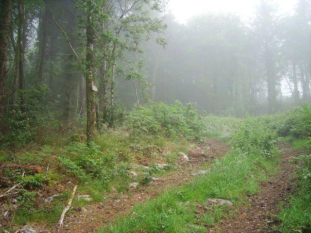 Photo could not load
S8324 : Carrickbyrne Hill
Richard Webb
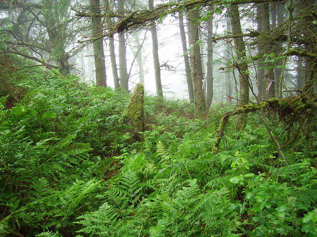 Photo could not load
S8324 : Standing Stone
Richard Webb
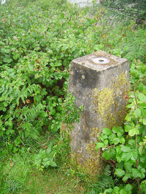 Photo could not load
S8324 : Carrickbyrne Hill
Richard Webb
Hill facts and local notes
Classifications
Elevation
234m
768 ft
Prominence
150m
Coordinates
52.3698, -6.7821
S830249
OS Map
76
At the Summit
At the summit, you will find a lovely stone cairn that some say is there to hold the spirits of those who couldn't make it. There's also a fantastic trig point, perfect for your obligatory summit selfie.
Terrain & Geology
Carrickbyrne Hill is predominantly composed of granite, which offers a unique and interesting insight into the geological history of this part of Ireland. The hill's rugged terrain is largely shaped by glacial activity, creating striking features and crags.
Views & Scenery
From the summit, one can enjoy panoramic views of the surrounding countryside, including the distant peaks of the Blackstairs Mountains and the lush valleys below. On a clear day, the coastline can also be glimpsed.
History & Heritage
Name Origin
The name 'Carraig Bhrain' translates to 'stone of the brine', likely referencing the hill's elevated position overseeing the local rivers.
Historical Significance
Carrickbyrne Hill has historical significance related to ancient farming and settlement patterns, with evidence of early human activity discovered nearby.
Getting There & Facilities
Check current local access restrictions, parking rules and transport timetables before travelling. These notes do not confirm public access to the summit.
Parking
There is a small car park at the entrance of Carrickbyrne Woods, which is the most convenient starting point for hikers.
Public Transport
Public transport options are limited, but you can reach nearby villages by bus, or consider carpooling. Local taxi services can also help.
Nearby Facilities
Facilities are limited in the immediate area, but New Ross has cafes and toilets to refresh after your hike.
Safety Information
Known Hazards
- Loose stones can create slipping hazards, particularly when descending. Weather can change rapidly, so be prepared for all conditions.
General Safety Tips
- Check weather conditions before setting out
- Carry appropriate clothing and equipment
- Let someone know your planned route
- Take a map, compass, and GPS device
- Carry emergency supplies: food, water, first aid kit, torch
Hills
Some common questions about the hills answered
Are there group walks up Carrickbyrne Hill [Carraig Bhrain]?
Many walkers use Walkmates to join or organise walks with others. You can check for group walks around Carrickbyrne Hill [Carraig Bhrain] through the maps
Are there other walkers around Carrickbyrne Hill [Carraig Bhrain]?
Activity varies by location and time, but Walkmates lets you see whether others have shared walks or shown interest in this area. Find other people through the walking friends search walking friends for Carrickbyrne Hill [Carraig Bhrain] search or of course create your own walk for Carrickbyrne Hill [Carraig Bhrain]
Can I organise a walk to Carrickbyrne Hill [Carraig Bhrain]?
Yes. If there aren’t any walks listed already, you can create a walk and make it available for others to join.
If you're signed up to Walkmates, you can create a walk to Carrickbyrne Hill [Carraig Bhrain].
How do I find a walk up this hill?
There are often multiple ways to walk this hill, depending on experience and route preference. Walkmates helps you explore walks and routes that others have shared.
Can I suggest a new route up Carrickbyrne Hill [Carraig Bhrain]?
Yes. You can suggest or create routes to share with others. Walkmates focuses on the social side of walking, so routes are used to help people organise walks and explore areas together, rather than as detailed navigation tools or route libraries.
Other uses really appreciate knowledgeable walkers sharing their routes. Share your favourite route to Carrickbyrne Hill [Carraig Bhrain] here
The is an error or something incorrect about this hill. How do I let you know?
We always strive to keep the information on Walkmates as accurate as possible. If you find an error, please let us know through the contact form and we'll aim to correct it as quickly as possible
Community Discussion
Comments
Location
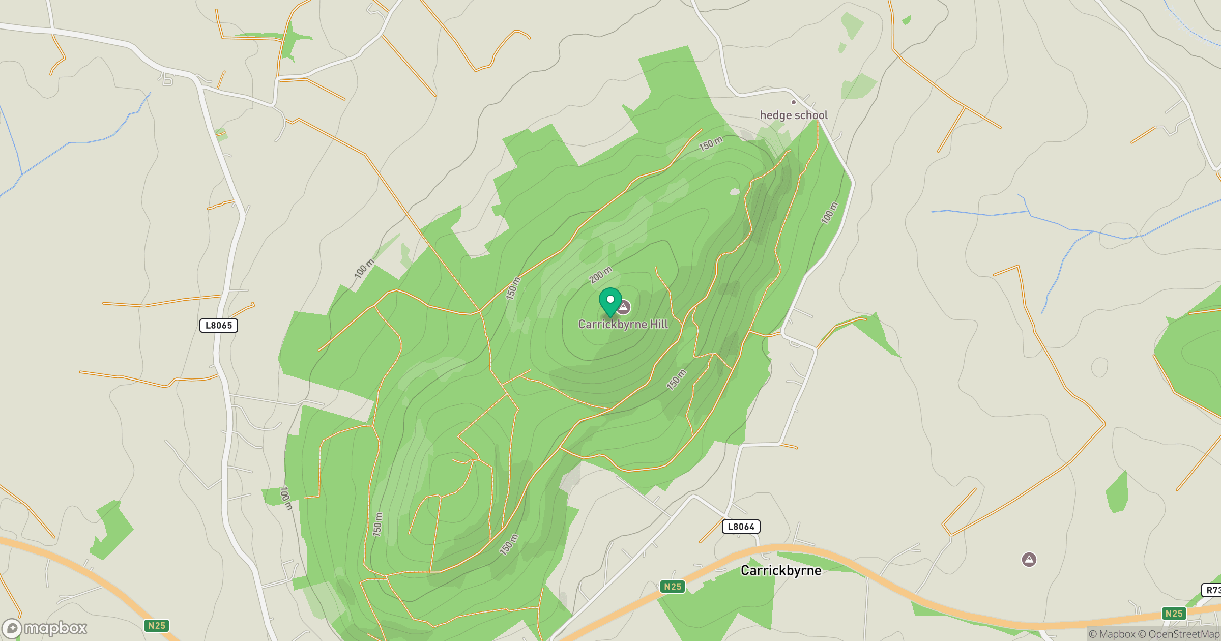
Grid reference: S830249
View on OpenStreetMapOpens a map in a new tab, centred on the hill.
Hills within 30 km
Straight-line distance, not a walking route or confirmation of access.
Lacken Hill
193m
Slievecoiltia [Sliabh Coltair]
268m
Bree Hill [Cnoc Bri]
179m
Blackstairs Mountain [Na Staighri Dubha]
732m
Forth Mountain [Sliabh Fothart]
237m
No comments yet. Be the first.